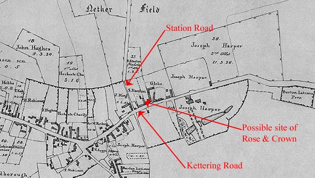
The first clue we have as to the existence of The Rose & Crown is based on a reference in the Burton Latimer Glebe Terrier dated May 1632 (terriers were surveys of the land and assets owned by each ecclesiastical parish in the country). It mentions "one farm house or inn called The Rose and Crown together with a yard and orchard and closse (paddock) ...in the occupation of Thomas Sherman." The reference seems to allude to a piece of land which we can now identify as being somewhere in the corner between the bottom of Station Road and Kettering Road pointing north. By 1803 the land belonged to Susanna Stanton, widow, as shown above in the enclosure map of that date.
The second reference is an advertisement in the Northampton Mercury dated 3rd July 1775 for an auction sale. It stated "TO be SOLD by AUCTION, by THOMAS BROUGHTON, (together or in seperate Lots, as shall be most agreeable to the Company) at the Rose-and-Crown in Burton Lattimer, near Kettering, on Thursday the 5th of July, between the Hours of Two and Five in the Afternoon.... " The sale particulars went on to describe four tenements in Church Street pleasantly situated near the church occupied by "Mrs. Buswell, E. Dunmore, W. Neal, and J. Grange" (Granger?) ... Also "a Freehold Grass Close known by the name of Braybrook's Close ...." This was the last close on the left at the bottom of Church Lane next to what is now the cemetery.
|