|
|||||||||||||
|
|||||||||||||
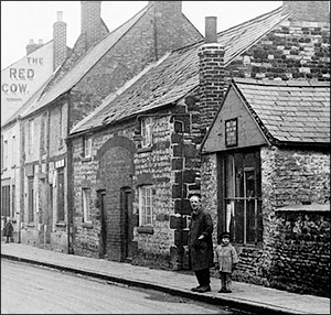
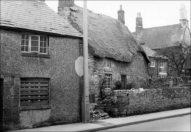
The east side of the High Street, northwards from the former farmhouse of Hilly Farm, is currently lined by a stretch of plain wall. Until the mid-1960s, it was fronted by a row of houses and a thatched cottage set back a little from the road (see photo above). Until the late 1940s there was a small shop in the north front corner of the cottage garden (see below), and together with the corner of the row beyond it, it formed a narrow passageway leading to a two sets of cottages, hidden from the High Street by the houses fronting it. These cottages formed Nichol's Yard, also known as Cooper's Yard - at the time, this was one of Burton's last surviving examples of the "yard" system of living.
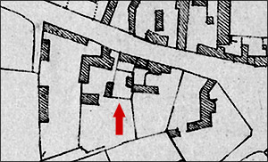
The origins of the yard can be traced back to the early nineteenth century. The Enclosure Map of 1805 (see below) shows that this area had begun to be developed as the town began to spread southwards along the High Street and away from the traditional core near the parish church. By the time the shoe and clothing industries arrived in the latter part of the century, the yards had already assumed their final form.
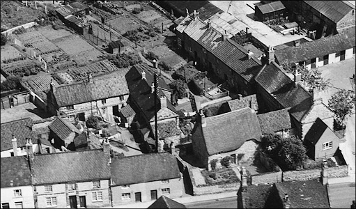
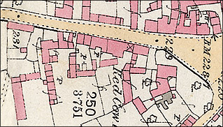
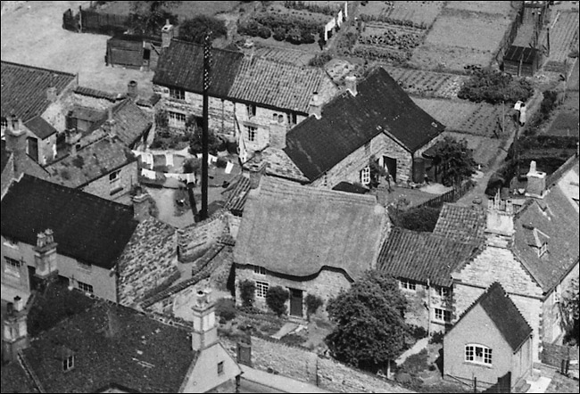
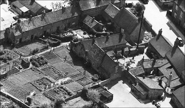
As can be seen from the maps and confirmed by examination of the aerial views, there were two yards. One mostly enclosed by the cottages of the yard and the rear of the houses on the High Street, and the other a row of cottages attached to the main house of Hilly Farm. In both cases, access was by the narrow passageway described above. The enclosed yard was typical of a system common in Burton and other local towns such as Irthlingborough and Finedon. In the first move away from continuous ribbon development down the length of a street, towns and villages could achieve a partial consolidation by developing land behind the street frontage, but without putting in access roads or lanes. Cottages were built in a courtyard arrangement, generally around a well or a pump. These can be identified by the W or P on the Ordnance Survey maps of the period 1880-1905. After that, mains water became increasingly available and the old wells and pumps were capped off. Gardens were small at best, and often just not provided. The outdoor washhouse was more important. The yards were usually accessed via a passageway, which might or might not be through an existing building. A good insight into the general living conditions in enclosed yards can be gained from the feature on Wallis' Yard, further down the High Street. The terraced set of houses also had its own pump, but had the additional benefit of a set of gardens because the site was far more open - see the aerial photographs below. What's in a name? There is as yet no clear consensus about the proper name of the yards. It is believed that most of the cottages were owned by John Nicholls, a mason and landowner, who built Nicholl's Row in Church Street. The term Cooper's Yard may have come about from someone named Cooper living in the yard at some time, or because some of the cottages were sold to John Cooper, a baker and parish councillor who also owned land in other parts of the High Street, including the land on which the Band Club was built. The 1881 and 1891 census and the 1918 electoral roll seems to prove that the yard was more often known as Nicho(l)l's Yard. The 1881 census shows six households and the 1891 census shows nine. The 1918 electoral roll gives ten households. Cooper's Yard is not given as an address in any census until 1911, though people in 1901 gave their address there as Cooper's Yard, so it seems possible that one yard might have been known as Nichol's Yard, and the other became known as Cooper's Yard.
Burton's last Yard
The aerial views of 1950 shown below give a good impression of the last years of a way of life which had gone on for well over a hundred years.
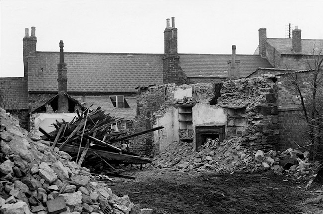
The demolition of the various yards and old terraces in town had begun in 1938 with Wallis Yard. Its tenants were moved to the newly-built council houses of George Street. This set the pattern - new building phases in town, and especially those houses erected by the Council, would provide new living accommodation for tenants of houses and cottages in areas which were scheduled for redevelopment. In 1960 it was the turn of Croxen's Yard, followed by the neighbouring Long Row in 1962. In April 1965 it was the turn of Nichol's Yard. Parts of the High Street frontage had already been altered. A section of the large thatched cottage standing between the yards and the High Street had been demolished in 1937, followed by the cobbler's shop in around 1950. The two small houses formed from the arched entranceway (see above) had been given a pebble-dashed rendered face by 1950, but ten years later they were empty and the ground floor windows were boarded up (see below).
|
|||||||||||||
